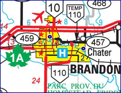
Launch :
The new boat launch
area in Dinsdale Park (near the dam) or the Kirkcaldy Drive landing.
Landing
: Drive straight east
on Richmond. Avenue, the road ends at the river.
Distance
: About 10 km
Time :
4 - 5 hrs.
See
Google Earth View
|
 |
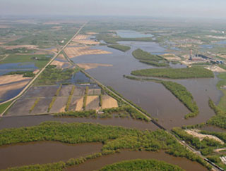
The river is
slow, especially in
late summer, with wide meanders. Watch out for Sea-Doos and motor
boats. For a shorter trip, exit on the left side, just past the reeds
as you approach the 3rd Street Dam. The first landmark past the dam is
the East End Railway Bridge. There is a difficult obstruction at the
steam plant, where they've built a sort of rock dam to keep the water
level up. You can walk the canoe around it. You pass the new bridge for
the Eastern Access Route and soon an island appears. If you travel to
the left you pass the mouth of a Willow Creek on the north side. Land
at site of what was once a makeshift crossing. A rough trail comes
right down to the bank.
|